Geoproximity vs. Geolocation: What’s the Difference?
Geolocation estimates where a device is; geoproximity determines whether it is near a place. Learn the accuracy, battery, privacy, and implementation trade-offs.
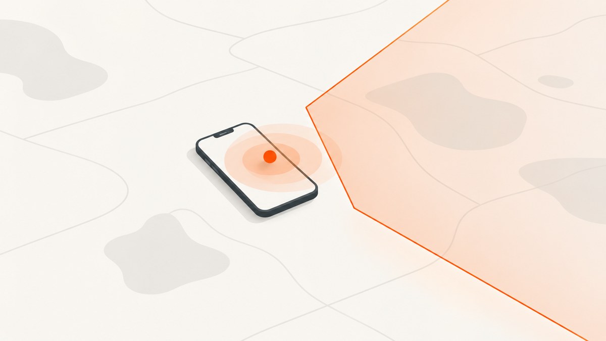
Geolocation answers “Where is it?” Geoproximity answers “Is it near this place?” Geolocation is a position estimate, usually latitude and longitude plus an uncertainty radius. Geoproximity describes a relationship between that estimate and a target place, region, or nearby beacon. A geofence is a common implementation: compare a location to a boundary and produce an enter, exit, or dwell event.
The distinction matters when you design permissions, battery behavior, data models, and user expectations. A coordinate is not a guarantee of exactness, and a proximity event is not proof that a person crossed a mathematically perfect line.
Geolocation and geoproximity at a glance
| Question | Geolocation | Geoproximity / geofencing |
|---|---|---|
| Primary question | What position or area estimate describes the device? | Is the device near a place, region, or beacon? |
| Typical output | Coordinates and an accuracy radius | Distance, nearby status, or enter/exit/dwell event |
| Inputs | Cell, Wi-Fi, GPS and sometimes IP-derived signals | A position estimate plus a region/rule, or beacon detection |
| Best fit | Maps, location-aware search, delivery tracking | Arrival reminders, venue entry, local interactions |
| Main failure mode | Uncertainty from weak or sparse signals | Noisy or delayed threshold decisions |
“Geoproximity” is descriptive language, not one standardized platform API in the reviewed sources. In platform documentation, look for geofencing, region monitoring, condition monitoring, or beacon proximity. Apple describes geographic enter/exit monitoring as condition monitoring, also called geofencing, and separately supports proximity to an iBeacon. See Apple Core Location region monitoring.
What geolocation actually returns
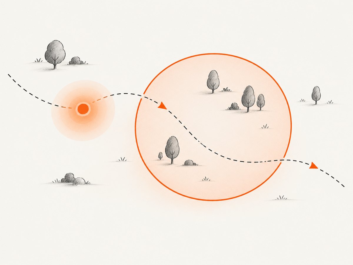
Google’s Geolocation API estimates latitude and longitude from cell-tower and Wi-Fi access-point observations and returns an accuracy radius. That radius tells you how far the true position may be from the estimate under the service’s model. Geolocation is different from geocoding, which converts between coordinates, addresses, and Place IDs.
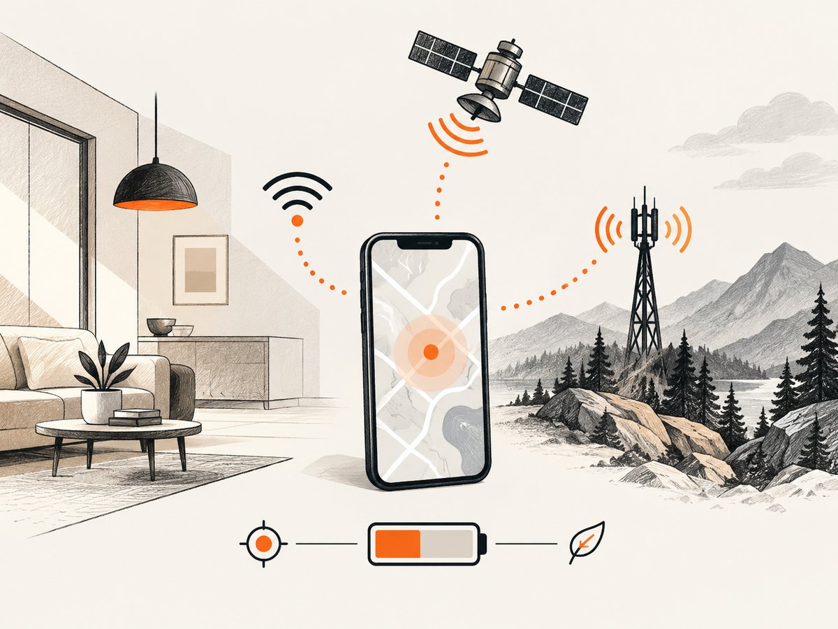
GPS is only one possible signal. A provider can combine satellite, cellular, Wi-Fi, device sensors, and, when enabled and other supplied signals cannot be geolocated, an IP-derived estimate. Signal availability, density, and strength change the result. Google’s documented examples illustrate the spread: with at least two Wi-Fi access points, a request can have a typical radius around 20 meters; macro-cell estimates commonly span hundreds of meters and may reach several kilometers in sparse areas; IP-derived estimates can have radii measured in thousands of meters. These are guidance for that API and those input conditions, not universal promises. See the Google Geolocation API documentation.
Model uncertainty explicitly
Store latitude, longitude, timestamp, provider, and accuracy radius together. Treat a fix with a 2,000-meter radius differently from one with a 20-meter radius. For a map marker, draw an uncertainty circle or communicate approximate location. For eligibility decisions, require a confidence policy instead of silently assuming the point is exact.
function distanceMeters(a, b) {
  const R = 6371000;
  const rad = d => d * Math.PI / 180;
  const dLat = rad(b.lat - a.lat);
  const dLon = rad(b.lon - a.lon);
  const x = Math.sin(dLat / 2) ** 2 +
    Math.cos(rad(a.lat)) * Math.cos(rad(b.lat)) * Math.sin(dLon / 2) ** 2;
  return 2 * R * Math.atan2(Math.sqrt(x), Math.sqrt(1 - x));
}

const user = { lat: 37.775, lon: -122.418, accuracy: 80 };
const place = { lat: 37.776, lon: -122.417 };
const fenceRadius = 150;
const distance = distanceMeters(user, place);
const confidentlyInside = distance + user.accuracy <= fenceRadius;
console.log({ distance, confidentlyInside });
This conservative check is an application policy, not a platform requirement. If the uncertainty circle overlaps the boundary, label the state unknown, request a better fix, or wait for a second observation.
What geoproximity means in practice
Proximity is a relationship or trigger. Your system chooses a target, a rule such as “within 150 meters” or “entered this polygon,” and an action such as notifying the user, unlocking a workflow, filtering results, or recording an event. A geofence can be circular or polygonal. A beacon rule uses short-range radio observations instead of a global boundary.
On Android, geofencing is built on the fused location provider and optimized for battery performance. Android 8.0 and later may deliver background geofence events every couple of minutes, so a trigger is not a real-time boundary crossing. Poor conditions can reduce accuracy to hundreds of meters or kilometers; Android recommends a larger fence in those environments. Read the Android geofencing documentation.
Apple supports monitored geographic conditions and documents a limit of up to 20 simultaneously monitored conditions per app. Users can change Location Services settings, and reduced-accuracy authorization can limit results regardless of a more demanding requested setting. See Apple’s monitoring guidance.
Design for hysteresis and dwell
GPS noise near a boundary can generate enter/exit chatter. Use two thresholds, require the state to persist for a dwell period, and deduplicate events by region, transition, and time. Persist the last accepted fix so a process restart does not create a duplicate arrival.
function transition(previous, distance, enterAt = 100, exitAt = 150) {
  if (previous !== 'inside' && distance <= enterAt) return 'inside';
  if (previous === 'inside' && distance >= exitAt) return 'outside';
  return previous;
}
let state = 'outside';
state = transition(state, 92);
state = transition(state, 120);
state = transition(state, 160);
Accuracy, timing, and battery trade-offs
Accuracy, update frequency, latency, privacy, and power are connected. Android identifies requested accuracy, how often a location is computed, and how quickly updates are delivered as battery factors. More frequent, faster, more accurate fixes generally require more work. Region monitoring can be optimized by the operating system, but it cannot overcome missing signals.
Apple advises apps to accept less accurate fixes when that is what the service can provide, including when a user authorizes reduced accuracy. Build a useful degraded path: show a broad area, defer a costly action, or ask the user to confirm.
| Need | Practical choice |
|---|---|
| Show a nearby list | Use a recent fix and sort by distance; display approximate results when accuracy is broad. |
| Arrival reminder | Use a platform geofence, hysteresis, and dwell; tolerate minute-level background latency. |
| Safety-critical decision | Do not rely on a single consumer fix; require stronger signals and an explicit fallback. |
| Beacon interaction | Use beacon ranging and region APIs and account for radio obstructions. |
Permissions, privacy, and data handling
A device may be able to calculate a position without your app being allowed to receive it. Location access is user-controlled. Explain why foreground or background access is needed, request the least privilege that supports the feature, and provide a way to disable monitoring. Android asks developers to explain the benefit when requesting background location for geofencing. Apple lets users change Location Services and precision settings.
Minimize retention. Keep the derived event, such as “entered store 42,” when raw coordinates are not needed. Encrypt data in transit and at rest, restrict access, and document retention and deletion. A proximity event can reveal routines even when you never store a map trail.
Implementation checklist
- Define the question: coordinate display, distance query, entry/exit, dwell, or beacon presence.
- Choose the platform API and required permission level.
- Record accuracy, timestamp, source, and authorization state with every fix.
- Set a radius larger than expected uncertainty; use polygons only when shape matters.
- Add hysteresis, dwell, event deduplication, and restart recovery.
- Test indoors, outdoors, underground, in dense cities, and in sparse rural coverage.
- Measure battery and delivery latency on supported OS versions.
- Explain approximate results and reduced-accuracy behavior in the UI.
- Log anonymized diagnostics so you can distinguish a missed event from denied permission.
Common mistakes and troubleshooting
“The geofence fired late”
Background delivery can be delayed; Android documents that events may arrive every couple of minutes on Android 8.0 and later. Check permission, app standby restrictions, device location settings, and whether the fence is too small for current accuracy.
“The device appears outside while standing inside”
Compare the reported accuracy radius with the fence radius. A 500-meter uncertainty cannot support a 100-meter claim. Increase the region, wait for a better fix, or show an unknown state.
“Enter and exit notifications repeat”
Noise around the threshold is the usual cause. Add hysteresis, dwell, and a cooldown key such as region ID plus transition. Persist state across restarts.
“No events arrive after installation”
Verify that Location Services are enabled, the app has the required foreground or background permission, and the monitored condition was registered successfully. On iOS, check whether the user selected reduced accuracy. On Android, confirm background-location rules and notification settings.
“IP location is far away”
IP-derived estimates can have radii of thousands of meters. Use IP only as a coarse fallback and never present it as GPS-level precision.
“The app drains the battery”
Reduce update frequency and requested accuracy, prefer platform region monitoring for arrival use cases, stop active updates when the feature is not visible, and avoid polling. Profile on real devices.
Or skip the browser setup
If your workflow needs screenshots of a page that explains a location result, use ScreenshotNeo instead of maintaining browser automation. One GET request returns PNG, JPEG, WebP, or PDF. Cookie and consent banners are accepted and removed before the shot, along with 60+ known consent platforms, newsletter popups, and chat widgets. Bot checks, blank pages, timeouts, failed loads, and cache hits are not billed; response headers identify the page verdict and billing status. An MCP server provides take_screenshot, get_page_info, and capture_pdf tools for Claude, Cursor, and other MCP clients.
See the ScreenshotNeo API documentation for all 63 options, including full-page lazy-image loading, CSS element capture, dark mode, device presets, retina scale, PDF controls, custom CSS and JavaScript, clicks, waits, blocking rules, headers, cookies, user agents, Authorization, timezone, geolocation, transparent backgrounds, resizing, TTL caching, signed links, async webhooks, bulk capture, usage, and OpenAPI compatibility.
curl -G "https://api.screenshotneo.com/v1/shot" -d access_key=YOUR_API_KEY --data-urlencode url=https://stripe.com -o shot.webpimport requests
r = requests.get("https://api.screenshotneo.com/v1/shot", params={"access_key": "YOUR_API_KEY", "url": "https://stripe.com"}, timeout=90)
open("shot.webp", "wb").write(r.content)const q = new URLSearchParams({ access_key: 'YOUR_API_KEY', url: 'https://stripe.com' });
const res = await fetch(`https://api.screenshotneo.com/v1/shot?${q}`);The free plan includes 1,000 screenshots per month with no card. Paid plans start at $5 for 3,000 shots; every feature is on every plan, and yearly billing gives two months free. Create a free ScreenshotNeo account.
Cost and reliability planning
Geolocation costs are usually expressed in battery, permission friction, and provider usage rather than a single per-event price. Cache a recent fix for read-only nearby lists, but do not reuse stale data for a safety decision. For geofence systems, monitor registration failures, delayed events, denied permissions, and OS-version changes. Keep server actions idempotent because retries and duplicate transitions are normal edge cases.
For screenshot capture, ScreenshotNeo bills only clean shots; bot checks, blank pages, timeouts, failed loads, and cache hits cost nothing. You can choose a cache TTL, use async jobs with signed webhooks, and capture up to 100 URLs per bulk call. Plans are Free 1,000/month, Starter $5/3,000, Growth $15/15,000, Pro $39/60,000, Scale $99/250,000, and Business $249/1,000,000.
FAQ
Is geoproximity the same as geofencing?
No. Geoproximity is a general relationship: “near this place.” Geofencing is one implementation that monitors a geographic region and emits transitions.
Does geolocation always mean GPS?
No. Providers can combine GPS, cellular, Wi-Fi, sensors, and sometimes IP-derived signals.
What radius should a geofence use?
There is no universal value. Choose a radius larger than expected uncertainty and validate it in the environments where users trigger it.
Can I guarantee an instant enter event?
No. Background limits, signal conditions, permissions, and platform scheduling affect delivery latency.
When should I use a beacon instead?
Use beacon proximity when a short-range local interaction is the requirement and you can deploy and maintain beacon hardware.